When GPS disappears, modern machines still need to know where they are. Underground mines, dense cities, forests, tunnels, warehouses, disaster zones, hostile jamming environments, and even other planets can all break or degrade satellite navigation. That is where computer vision-based navigation systems become essential: they use cameras, depth sensors, and intelligent algorithms to interpret the world visually and estimate motion, position, and orientation without relying on satellite signals.
TLDR: Computer vision-based navigation helps drones, robots, vehicles, and wearable systems move through GPS-denied environments by interpreting visual cues from cameras and sensors. The top approaches include visual odometry, visual inertial odometry, SLAM, depth-based navigation, optical flow, and AI-powered semantic navigation. The best systems usually combine cameras with IMUs, LiDAR, radar, or maps to improve accuracy, reliability, and safety in complex conditions.
Why GPS-Denied Navigation Matters
GPS is one of the most important technologies of the modern era, but it is not universal. Signals from satellites are weak by the time they reach Earth, which means they can be blocked by buildings, absorbed by earth and concrete, reflected by glass, or intentionally jammed. For autonomous systems, this creates a serious challenge: they must continue moving safely when the most familiar positioning source becomes unreliable.
In these conditions, vision becomes a powerful substitute. Cameras can detect walls, doors, road markings, rocks, trees, machinery, signs, people, and countless other visual landmarks. By comparing what they see from one moment to the next, navigation systems can estimate how far they have moved and in which direction. More advanced systems can also build maps, recognize places, avoid obstacles, and make decisions based on the meaning of objects in the scene.
1. Visual Odometry: Estimating Motion from Images
Visual odometry, often called VO, is one of the core technologies behind GPS-free navigation. It works by tracking visible features across a sequence of images and estimating the motion of the camera between frames. If a robot sees the corner of a wall, a crack in the floor, or a pattern on a shelf, the system can calculate how those features shift as the robot moves.
There are two major types of visual odometry:
- Monocular visual odometry: Uses a single camera. It is lightweight and inexpensive, but it can struggle with determining true scale unless additional information is available.
- Stereo visual odometry: Uses two cameras separated by a known distance, similar to human eyes. This provides depth information and improves distance estimation.
Visual odometry is widely used in drones, mobile robots, augmented reality headsets, and planetary rovers. Its main advantage is that it can be implemented with relatively low-cost cameras. However, it can drift over time, meaning small errors accumulate as the system moves. For this reason, VO is often combined with other sensors.
2. Visual Inertial Odometry: Cameras Plus Motion Sensors
Visual inertial odometry, or VIO, combines cameras with an inertial measurement unit, usually known as an IMU. An IMU measures acceleration and rotation using accelerometers and gyroscopes. The camera provides rich environmental information, while the IMU provides high-frequency motion data.
This combination is especially valuable because cameras and IMUs have complementary strengths. Cameras are excellent at correcting drift and recognizing the environment, but they may fail temporarily in darkness, blur, or featureless spaces. IMUs work even in darkness and can measure rapid motion, but their estimates drift quickly over time. Together, they create a more stable and responsive navigation system.
VIO is one of the most important technologies for autonomous drones. Small drones flying indoors cannot rely on GPS, and they need fast, lightweight localization to avoid walls, pass through doorways, and maintain stable flight. VIO is also common in mixed reality devices, inspection robots, autonomous forklifts, and handheld mapping tools.
3. SLAM: Mapping and Localization at the Same Time
Simultaneous Localization and Mapping, better known as SLAM, is one of the most powerful solutions for GPS-denied navigation. SLAM allows a system to build a map of an unknown environment while also locating itself within that map. In practical terms, a robot using SLAM can enter a building it has never seen before, map corridors and rooms, and continuously estimate its own position.
Computer vision-based SLAM can use monocular cameras, stereo cameras, RGB-D cameras, event cameras, or combinations of multiple sensors. Some systems create sparse maps made of key visual features, while others build dense 3D reconstructions of surfaces and obstacles.
Popular forms include:
- Feature-based visual SLAM: Tracks distinctive points such as corners, edges, and textured patterns.
- Direct visual SLAM: Uses pixel intensity changes rather than relying only on extracted features.
- RGB-D SLAM: Uses color and depth data to build detailed indoor maps.
- Semantic SLAM: Adds object recognition, allowing the system to understand that it is seeing a chair, doorway, vehicle, or person.
SLAM is used in autonomous robots, warehouse automation, search and rescue machines, underground inspection systems, and AR/VR headsets. Its ability to create maps makes it particularly useful where pre-existing maps are unavailable or outdated.
Image not found in postmeta4. Depth Camera Navigation: Seeing the World in 3D
Depth cameras measure the distance between the sensor and objects in the environment. They can use structured light, time-of-flight sensing, or stereo vision. Unlike ordinary cameras, depth cameras produce a 3D understanding of the scene, helping robots detect obstacles, measure clearances, and plan safe paths.
RGB-D navigation combines a standard color image with depth data. This approach is especially effective indoors, where robots must move around furniture, shelves, walls, and people. Service robots, delivery robots, autonomous forklifts, and inspection platforms often use depth cameras for local navigation.
Depth cameras are excellent for short-range navigation, but they have limitations. Some struggle outdoors in direct sunlight, while others have limited range or difficulty with reflective and transparent materials. Still, when combined with visual odometry or SLAM, they provide a strong foundation for GPS-denied movement.
5. Optical Flow Navigation: Inspired by Insects
Optical flow is the pattern of apparent motion of objects across a camera’s view. When a drone flies forward, nearby objects appear to move quickly across the image, while distant objects move slowly. By measuring this motion, a navigation system can estimate speed, direction, and proximity to obstacles.
This technique is famously inspired by insects such as bees and flies, which navigate using visual motion cues rather than GPS. Optical flow is particularly useful for small drones because it can be computationally efficient and does not always require detailed maps.
Typical applications include:
- Drone stabilization: Holding position indoors or near the ground.
- Obstacle avoidance: Detecting nearby walls, trees, or structures.
- Landing assistance: Estimating ground speed and height during descent.
- Corridor following: Keeping a robot or drone centered between walls.
Optical flow works best in environments with visible texture and adequate lighting. Featureless floors, fog, darkness, or rapid camera motion can reduce performance. Even so, it remains a valuable component in lightweight navigation stacks.
6. AI-Powered Semantic Navigation
Traditional navigation systems estimate geometry: where the walls are, how far away obstacles are, and how the camera is moving. Semantic navigation adds another layer: understanding what things are. Using deep learning models, a robot can recognize doors, stairs, roads, lanes, signs, people, vehicles, tools, shelves, and hazardous areas.
This makes navigation more intelligent. For example, a warehouse robot can identify aisles and loading zones. A rescue robot can prioritize open doorways or detect blocked passages. An autonomous vehicle in an urban canyon can use building edges, lane markings, traffic lights, and crosswalks to maintain awareness when GPS is unreliable.
AI-powered vision is also useful for place recognition. Instead of merely tracking motion frame by frame, the system can recognize that it has returned to a previously visited location. This helps reduce drift and improves long-term map consistency.
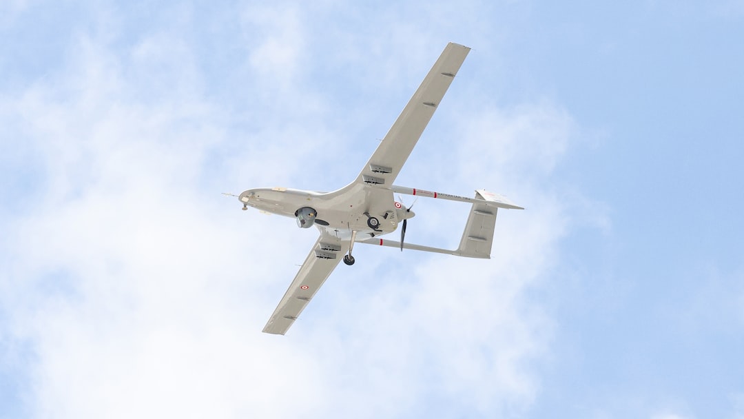
7. Visual Navigation for Drones
Drones are among the most demanding users of GPS-denied navigation because they move in six degrees of freedom and have little margin for error. Indoors, underground, under bridges, in forests, or in military environments, GPS can be absent or untrusted. Vision-based navigation allows drones to inspect infrastructure, map mines, enter collapsed buildings, and fly through complex spaces.
The strongest drone systems often combine:
- VIO for fast local position estimation.
- SLAM for map building and loop closure.
- Depth sensing for obstacle avoidance.
- Optical flow for low-altitude stability.
- AI perception for recognizing landing zones, hazards, and mission targets.
The trend is toward smaller, more efficient onboard processors that can run advanced vision algorithms in real time without relying on cloud connectivity. This is crucial in remote or dangerous environments where communication links may be unreliable.
Image not found in postmeta8. Vision-Based Navigation for Ground Robots
Ground robots use computer vision in warehouses, hospitals, farms, factories, tunnels, and disaster sites. In these settings, GPS is often unavailable or too inaccurate. A robot may need to move through narrow aisles, avoid pedestrians, dock with charging stations, inspect equipment, or carry payloads from one point to another.
For indoor robots, cameras can detect visual landmarks such as floor patterns, shelf edges, doors, signs, and ceiling features. In outdoor GPS-denied areas, such as forests or urban canyons, vision systems can track terrain, tree trunks, rocks, building facades, and road boundaries.
Ground robots often benefit from sensor fusion. Cameras provide rich visual data, but wheel encoders, IMUs, LiDAR, and radar can improve robustness. For example, wheel odometry may work well on smooth floors but fail on slippery ground. Vision can correct those errors by comparing observed motion against visual landmarks.
9. Navigation in Underground and Industrial Environments
Underground mines, sewage tunnels, subway systems, and industrial plants are some of the toughest places for navigation. They may be dark, dusty, repetitive, wet, smoky, or visually confusing. GPS is usually completely unavailable, and wireless communication can be poor.
Computer vision systems in these environments must be rugged and often need active lighting. Stereo cameras, thermal cameras, event cameras, and depth sensors can all play a role. In mines, autonomous vehicles can use visual SLAM to map tunnels and monitor changes in the environment. In industrial plants, inspection robots can recognize gauges, pipes, valves, and structural defects while maintaining their position.
The key challenge is reliability. A navigation system cannot fail simply because a tunnel wall looks similar for hundreds of meters. To prevent this, advanced systems use loop closure, multi-sensor fusion, and environmental priors. Some also incorporate topological maps, which represent areas as connected places rather than exact coordinates.
10. Event Cameras and Next-Generation Vision Sensors
Most standard cameras capture full images at fixed intervals. Event cameras work differently: they detect changes in brightness at individual pixels and report only those changes. This gives them extremely high temporal resolution, low latency, and excellent performance in high-speed or high dynamic range scenes.
For navigation, event cameras are promising because they can handle rapid motion and challenging lighting better than conventional cameras. A fast-moving drone, for instance, may experience motion blur with a normal camera, while an event camera can still track changes in the scene. These sensors are increasingly being researched for agile robotics, autonomous flight, and low-power navigation.
Other emerging sensors include neuromorphic vision chips, compact thermal cameras, and advanced stereo systems. As hardware improves, the boundary between perception and navigation continues to shrink: the same visual system that helps a robot localize itself can also help it understand and interact with the world.
Key Challenges in Vision-Based Navigation
Despite its strengths, computer vision navigation is not perfect. Real-world environments are messy, and visual systems must handle many difficult conditions.
- Lighting changes: Bright sunlight, darkness, shadows, glare, and flickering lights can confuse cameras.
- Textureless surfaces: Plain white walls, smooth floors, and uniform tunnels provide few features to track.
- Dynamic objects: People, vehicles, animals, and moving machinery can create false motion cues.
- Drift: Small errors accumulate over time unless corrected through loop closure or external references.
- Computational load: Real-time vision processing can require significant onboard computing power.
- Environmental damage: Dust, rain, fog, mud, vibration, and lens contamination can degrade performance.
The best systems address these issues through redundancy. They do not depend on vision alone; instead, they fuse camera data with IMUs, LiDAR, radar, wheel encoders, barometers, magnetometers, or preloaded maps. This layered approach makes navigation more resilient.
What Makes a Top System?
A high-quality GPS-denied navigation system is not defined by one sensor or one algorithm. It is defined by how well it performs under pressure. The best systems are accurate, robust, real-time, and adaptable. They recover from temporary sensor failures, handle unfamiliar environments, and provide trustworthy position estimates even when the world looks chaotic.
Important evaluation criteria include:
- Localization accuracy: How close the estimated position is to the true position.
- Drift rate: How quickly errors accumulate over distance or time.
- Map quality: How useful and consistent the generated map is.
- Latency: How quickly the system reacts to new sensor data.
- Power efficiency: Especially important for drones and small robots.
- Failure recovery: Whether the system can relocalize after losing track.
The Future of GPS-Denied Navigation
The future of computer vision-based navigation will be shaped by smarter algorithms, better sensors, and more powerful edge computing. AI models will improve scene understanding, allowing robots to navigate not just by geometry but by purpose. A robot will not merely identify an opening; it will understand that it is a doorway leading to a room. A drone will not simply avoid a cable; it will recognize it as a power line and adjust its inspection behavior accordingly.
Another major trend is collaborative navigation. Multiple robots or drones can share maps and observations, helping each other localize in GPS-denied spaces. This is valuable for search and rescue, warehouse fleets, military operations, and large-scale inspection tasks.
As these technologies mature, GPS-denied navigation will become less of an exception and more of a standard capability. Machines will be expected to operate confidently in buildings, tunnels, forests, cities, and remote industrial sites. Computer vision will be central to that shift because it gives autonomous systems something close to a human sense of sight: the ability to look around, recognize patterns, learn from movement, and make decisions based on what the world actually looks like.
In short, the top computer vision-based navigation systems are not replacing GPS everywhere; they are filling the critical gaps where GPS fails. Whether through visual odometry, VIO, SLAM, depth sensing, optical flow, or semantic AI, these systems are giving autonomous machines the ability to move through the unknown with confidence.